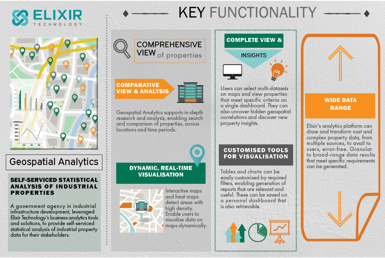
A government agency in industrial infrastructure development leveraged Elixir Technology’s business analytics tools and solutions to provide self-serviced statistical analysis of industrial property data for their stakeholders.
Comprehensive View of Properties for In-depth Analysis
Elixir Technology’s business analytics tools and solutions comprises geospatial analytics – gathering, displaying and analysing geographic information systems (GIS) – to support stakeholders ranging from industry professionals to researchers, in accessing complex and enormous amounts of industrial property data for in-depth analysis.
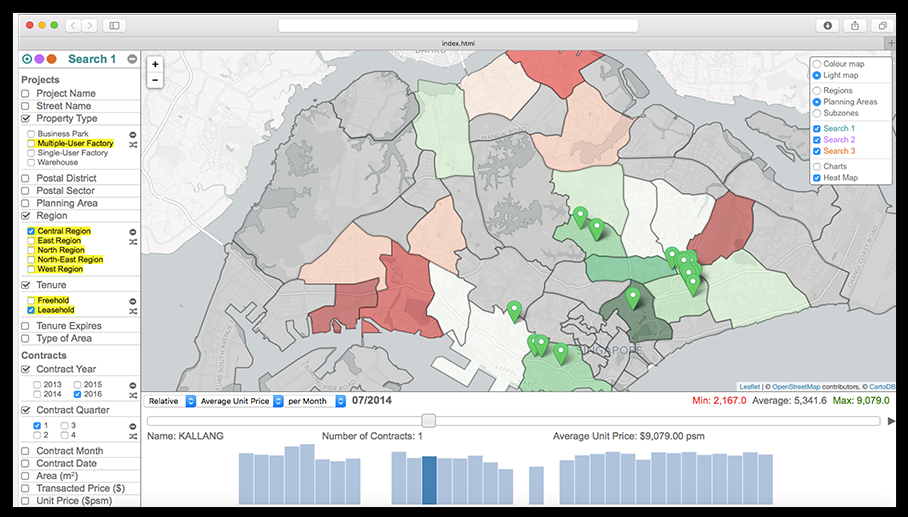
Geospatial analytics enables users to get a comprehensive view of properties including conducting comparative analysis through searching, comparing and evaluating various properties on the map that could be based on parameters like locations and time periods.
The interactive maps and heat maps available in geospatial analytics also support dynamic, interactive visualisation as they help users to highlight areas with high population density based on filters and criteria.
Generation of New Insights
With geospatial analytics, stakeholders are able to select multi-datasets and specified filters to view required properties on the map, all on a single dashboard. The viewing of multiple strings of data on a map as compared to data presented in tabular forms, can potentially uncover hidden geospatial correlations and reveal critical new insights for the company.
Easy Access to Wide Data Range
Having a comprehensive and credible data repository is important for stakeholders to make informed, timely decisions. Elixir’s analytics platform can draw and transform vast and complex property data from multiple, disparate sources, to avail to users, error-free. Granular to broad-range data results that meet specific requirements can be generated.
The agency has set a new benchmark in delivering a self-serviced, user-centric data solution, where its highly interactive and dynamic statistical and geospatial visual analytics will be the new norm for all open data initiatives.